Recent Blog Posts

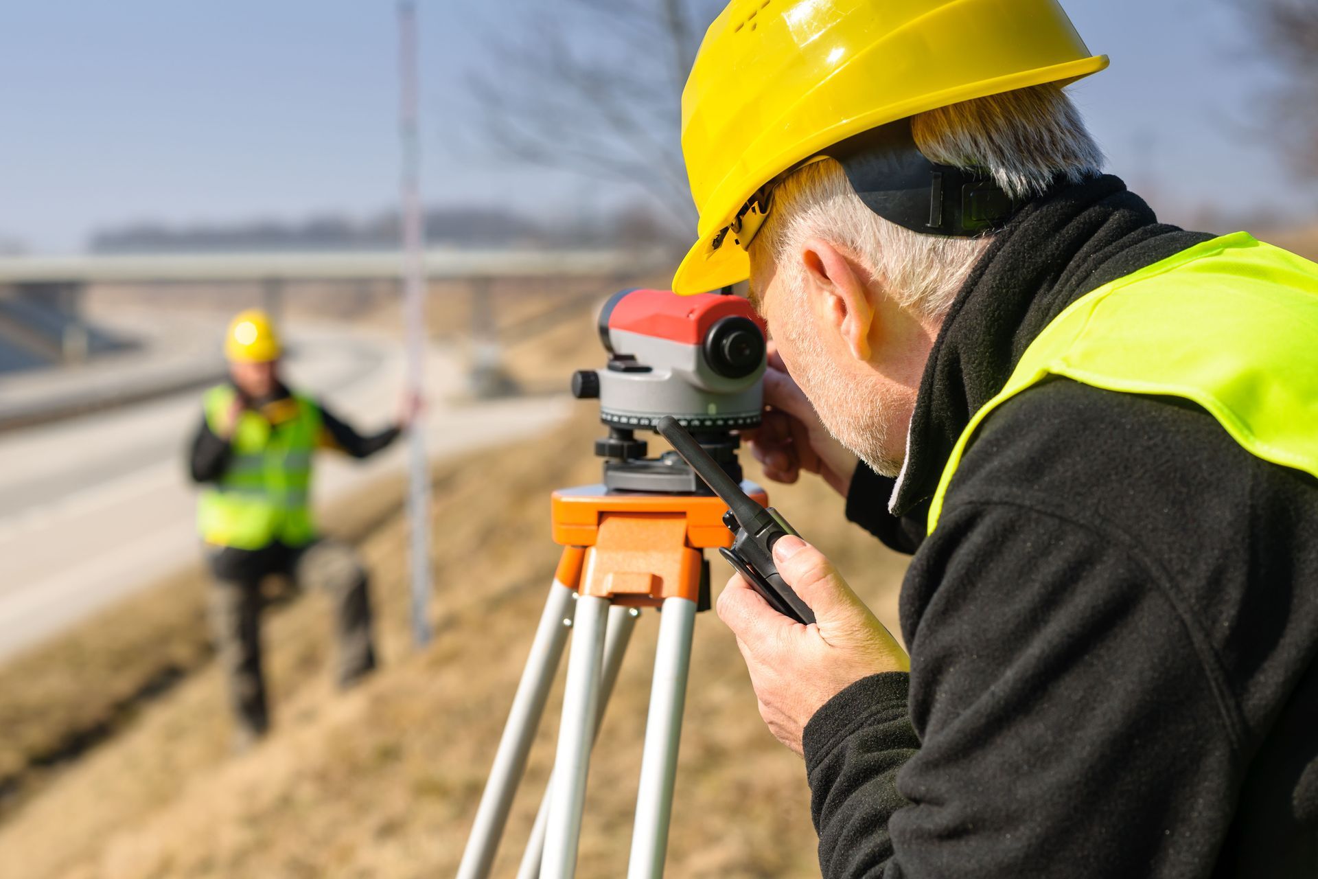

Topographic Surveys
Buford, GA
Founded in 1978
High-Quality, Cost-Effective Services
Uses the Latest Leica Equipment
Request Lorem Epsom
Hero Request Form
Thank you for contacting us.
We will get back to you as soon as possible.
Please try again later.
Get Accurate Topographic Surveys for Your Project Today
Need precise topographic surveys for your land development project? Floyd & Associates Inc is here to help. We offer comprehensive topographic survey services, providing detailed information about the natural and man-made features of your property. Our services include:
- Elevation contours
- Buildings and structures
- Roads and driveways
- Trees and vegetation
- Utility lines and poles
- Water features
- Fences and walls
Accurate data keeps your project on track.
Reach out to us for reliable topographic surveys that'll set your project up for success.
Topographic Surveys: The Foundation of Successful Land Development
Topographic surveys are crucial for various projects, from construction and landscaping to environmental studies. They provide essential data that helps you:
- Plan construction projects effectively
- Identify potential drainage issues
- Comply with local zoning regulations
- Calculate earthwork volumes
- Design efficient irrigation systems
- Assess flood risks
With accurate topographic data, you'll make informed decisions and avoid costly mistakes down the line. Our team at Floyd & Associates ensures you have the precise information you need to move forward confidently.
Why Choose Floyd & Associates
When it comes to topographic surveys, Floyd & Associates stands out from the crowd. Here's why clients trust us for their surveying needs:
- Accurate, cost-effective services
- Family-owned company founded in 1978
- Reliable team of professional land surveyors
- Use of the latest Leica equipment for precise measurements
- Locally owned and operated
- Second-generation company With a deep understanding of the area
Our commitment to excellence and customer satisfaction sets us apart. We partner With you on successful land development projects.
Planning Your Next Project With Precision Data
Every successful land development project begins by laying a solid foundation of accurate and comprehensive site data. Before you break ground, it is essential to understand the exact contours, elevations, and existing features of your specific parcel. By hiring experienced topographic land surveyors in Buford, GA, you ensure that architects, engineers, and construction teams have the exact measurements they require to design safely. Whether you are preparing to build a new commercial facility, designing a residential subdivision, or updating municipal infrastructure, having a highly detailed map prevents costly surprises. Reliable data allows your entire team to foresee drainage complications, grade the land properly, and adhere strictly to all regional zoning requirements.
How Our Team Supports Local Development Goals
Navigating the complexities of local building codes and environmental regulations can be challenging without the right professionals. We know this community inside and out because we have been working throughout the area for more than seven decades. When developers and property owners need dependable topographic land surveyors in Buford, GA, they rely on our family-owned company to deliver meticulous results. Our deep roots mean we understand the unique soil conditions, common terrain variations, and specific municipal standards that affect your build. We collaborate closely with project managers to provide mapping solutions that keep timelines intact. By choosing a second-generation surveying firm, you gain a partner deeply invested in the long-term success of the local landscape.
Advanced Equipment for Accurate Property Mapping
Modern surveying requires more than just experience; it demands cutting-edge technology that leaves zero room for error. We proudly utilize the latest Leica equipment to capture precise measurements across any terrain. As dedicated topographic land surveyors in Buford, GA, we understand that even a fraction of an inch can significantly impact your engineering plans. High-tech instruments allow us to map out everything from subtle elevation changes and dense vegetation to existing utility lines and water bodies with incredible speed. This commitment to utilizing premium tools ensures that the formats we deliver are flawless representations of your property. Superior equipment ultimately translates to cost-effective services, preventing expensive revisions during the construction phase.
Long-Term Benefits of Comprehensive Site Analysis
Investing in a thorough site analysis pays dividends long after the initial construction phase is complete. A detailed map does much more than secure your building permits; it serves as a permanent record of the land's structural layout. People looking for seasoned topographic land surveyors in Buford, GA often realize that our detailed reports help them optimize future expansions and property modifications. Knowing the exact location of underground features, boundaries, and natural slopes helps property managers implement highly efficient irrigation systems and proactive flood prevention measures. These careful considerations enhance the value of the real estate and protect your investment from unexpected environmental challenges or boundary disputes.
Getting Started on Your Commercial or Residential Build
Taking the first step toward a new development can feel overwhelming, but securing necessary land data does not have to be a stressful process. Our team is ready to evaluate your site requirements and determine the appropriate level of detail needed for your unique goals. You deserve to work alongside top-tier topographic land surveyors in Buford, GA who prioritize clear communication and outstanding customer service from the initial consultation to final map delivery. Whether you are dealing with a small residential lot or a massive commercial acreage, we approach every job with rigorous attention to detail. Contacting the top-rated topographic land surveyors in Buford, GA is the absolute best way to successfully secure your project's future and guarantee long-term peace of mind.
Contact Us
Ready to get started on your topographic survey? Our team at Floyd & Associates is ready to provide the accurate, detailed topographic data you need to move forward With confidence.
Contact us today to discuss your topographic survey needs and experience the Floyd & Associates difference.
- Bullet text
- Bullet text
- Bullet text
- Bullet text
- Bullet text
- Bullet text
- Bullet text
- Bullet text
- Bullet text
- Bullet text
Title or Question
Describe the item or answer the question so that site visitors who are interested get more information. You can emphasize this text with bullets, italics or bold, and add links.Title or Question
Describe the item or answer the question so that site visitors who are interested get more information. You can emphasize this text with bullets, italics or bold, and add links.Title or Question
Describe the item or answer the question so that site visitors who are interested get more information. You can emphasize this text with bullets, italics or bold, and add links.