July 17, 2026
Building America's roads, bridges, and commercial complexes requires an immense amount of preparation before the first shovel touches the earth. In an era marked by rapid technological advancement and tight regulatory frameworks, the foundational stages of development have become more rigorous than ever. At the heart of this preliminary phase are new construction surveys, which serve as the definitive blueprint for transforming architectural concepts into a tangible reality. Far from being a mere administrative formality, these comprehensive assessments ensure that modern engineering feats are structurally sound, legally compliant, and financially viable from inception through to completion.
Mitigating Costly Spatial Errors Through Engineering Precision
Preventing Structural Alignment Anomalies
One of the primary objectives of conducting new construction surveys is to prevent structural alignment anomalies before they escalate into systemic failures. When large-scale infrastructure projects are executed, even a microscopic deviation from the engineering plans can result in catastrophic misalignments. By establishing exact spatial reference points, field technicians ensure that foundations, structural steel columns, and utility corridors are placed precisely where they belong. This level of accuracy is essential for high-rise buildings, highway overpasses, and heavy civil engineering projects where structural integrity cannot be compromised.
Reducing Expensive Field Rework
In addition to ensuring physical stability, accurate spatial data directly influences the financial health of a project. When errors are discovered late in the development process, the cost of remediation can be staggering. Utilizing comprehensive surveying methodologies early on minimizes the need for expensive field rework, keeping projects on schedule and within budget. By identifying discrepancies between architectural plans and physical topography prior to excavation, development teams can adjust their approaches without incurring costly construction delays or material waste.
Utilizing Advanced Technology to Shape Modern Geodesy
Maximizing Field Accuracy with Advanced Scanning Equipment
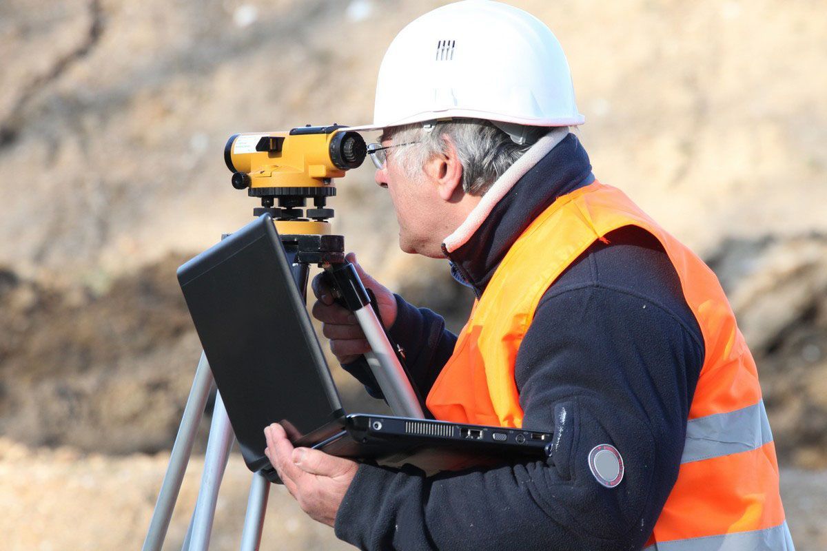
The landscape of land measurement has evolved dramatically, moving away from manual calculations toward highly automated, digitized workflows. Modern firms optimize their field operations by utilizing the latest Leica equipment, which provides unparalleled accuracy in data collection. This advanced technology includes robotic total stations, high-definition 3D laser scanners, and global navigation satellite system receivers. By capturing millions of data points per second, these tools allow field crews to map intricate details of a project site with millimeter-level precision.
Streamlining Design Integration with Digital Modeling
The digital data gathered during the initial site assessment integrates seamlessly into modern building information modeling software and geographic information systems. This digital connectivity ensures that engineers, architects, and project managers have access to a single, verified source of spatial data. As a result, new construction surveys provide a dynamic framework that supports collaborative design, clash detection for underground utilities, and real-time adjustments throughout the lifecycle of the infrastructure development.
Managing Environmental and Topographical Realities
Assessing Existing Topographical Features
Before an infrastructure project can be designed, engineers must possess a thorough understanding of the existing terrain. Conducting comprehensive topographic surveys allows development teams to visualize elevation changes, natural contours, utility corridors, and existing vegetation. This data is critical for determining grading plans, calculating cut-and-fill volumes, and designing effective stormwater management systems that prevent future flooding and erosion.
Incorporating Specialized Asset Mapping
Beyond basic topography, modern infrastructure demands specialized environmental mapping to address specific ecological and structural variables. For instance, incorporating tree surveys helps developers identify protected vegetation and comply with local environmental preservation ordinances. Similarly, when projects are located in low-lying or coastal areas, obtaining official flood certifications is vital for evaluating flood risks, designing resilient structures, and securing appropriate insurance coverage for the finished asset.
Facilitating Ongoing Development and Quality Assurance
Implementing Precise Structural Layouts
As a project transitions from the design phase to physical execution, the theoretical coordinates on a computer screen must be translated accurately onto the earth. Through a rigorous process known as construction layout, surveyors place physical stakes and markers across the job site to guide grading crews, excavation teams, and concrete contractors. This ongoing guidance ensures that the physical build mirrors the approved engineering designs down to the smallest detail.
Validating Final Compliance with Post-Construction Mapping
The role of spatial measurement does not end once the final coat of paint is applied. As the project nears completion, conducting thorough as-built surveys is essential to verify that the infrastructure was constructed in accordance with the permitted plans and zoning regulations. These final assessments document the exact location and elevation of all completed structures, utility lines, and roadways. The resulting data provides owners, municipalities, and future utility operators with an accurate historical record of the asset.
Supporting a Specialized and Growing Workforce
Addressing Long-Term Industry Workforce Demands
The growing complexity of modern infrastructure has driven a consistent, long-term demand for highly skilled spatial measurement professionals. According to the Bureau of Labor Statistics, on average, about 3,900 job openings for land surveyors are expected each year over the next decade. This projected growth underscores the enduring importance of the profession in supporting national infrastructure initiatives, expanding transit networks, and rebuilding aging urban centers.
Leveraging Institutional Knowledge for Modern Projects
While technology continues to advance, the human element remains irreplaceable. Successfully interpreting historical land records, navigating complex legal descriptions, and resolving conflicting boundary claims requires a high degree of expertise. Firms that possess 75-plus years of experience bring an invaluable repository of institutional knowledge to modern job sites. This deep understanding of regional land history, combined with modern technical proficiency, ensures that complex engineering projects are built upon a foundation of verifiable facts.
Integrating Comprehensive Spatial Services for Infrastructure Success
Aligning Diverse Surveying Disciplines
Major infrastructure developments, such as highways, pipelines, or rail networks, require the synchronization of multiple specialized disciplines. For linear projects, implementing detailed route surveys is critical for determining the optimal path, evaluating rights-of-way, and identifying potential obstacles over long distances. For commercial real estate transactions and major redevelopments, securing comprehensive ALTA/NSPS land title surveys ensures that titles are clear and that all easements, encumbrances, and structural improvements are fully documented for lenders and title companies.
Cultivating Sustainable Urban Growth
As urban centers become more densely populated, the responsible allocation of space is paramount. Whether establishing multi-family residential complexes or complex commercial developments, utilizing precise surveying services allows cities to grow sustainably. From organizing complex condominium sites to partitioning large parcels of land into organized subdivisions, professional land measurement ensures that new developments integrate harmoniously with existing municipal infrastructure and public utility systems.
Enhancing Long-Term Asset Lifecycle Management
Creating Digital Twins for Maintenance
The utility of new construction surveys extends far beyond the immediate construction phase; the data collected serves as the bedrock for long-term asset management. Modern infrastructure operators increasingly rely on "digital twins"—exact virtual replicas of physical assets—to monitor structural health, plan maintenance schedules, and manage facility operations. The highly accurate spatial data captured during initial and post-construction assessments provides the precise geometric foundation required to build these digital models, thereby maximizing the operational life of the asset.
Ensuring Public Safety through High-Quality Services
Ultimately, the most critical contribution of precise spatial measurement to modern infrastructure is the preservation of public safety. Roads, bridges, and utility networks must withstand immense physical stress and environmental factors over many decades. By providing high-quality, cost-effective services during the foundational stages of a project, land surveying professionals ensure that these structures are built on stable ground and in strict compliance with safety regulations, protecting the communities that rely on them daily.
Modern infrastructure represents the backbone of economic vitality and societal progress, demanding the highest levels of precision, safety, and legal compliance. As demonstrated across all phases of development,
new construction surveys are not merely optional administrative steps, but are fundamental requirements for responsible engineering. By combining decades of institutional experience with sophisticated technology, professional land surveyors transform complex, high-stakes concepts into safe, enduring realities. As the built environment continues to expand and evolve, the role of precise spatial data will remain a cornerstone of successful, resilient, and forward-thinking development. If you have land in need of surveying, contact Floyd & Associates Inc for your free estimate.